Object
Title: Cloud Service for Analysis and InteractiveVisualization of Weather Data in Armenia ; Облачный сервис для анализа и интерактивной визуализации данных о погоде в Армении
Co-author(s) :
Abrahamyan Rita ; Абраамян Рита
Abstract:
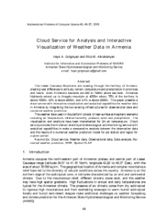
The Lesser Caucasus Mountains are crossing through the territory of Armenia, creating vast differences in altitude, terrain, temperature and precipitation in provinces and towns. Even Armenia’s lowlands are 500 to 1500m above sea level. Armenias highlands extend up to Aragats mountain at 4090m where, 75% of the territory is above 1000m, 50% is above 2000m, and 3.4% is above 3000m. This paper presents a cloud service with interactive visualization and analytical capabilities for weather data in Armenia by integrating the two existing infrastructures for observational data and numerical weather prediction. The weather data used in the platform consist of near-surface atmospheric elements including air temperature, relative humidity, pressure, wind and precipitation. The visualization and analitycs have been implemented for 2m air temperature. Cloud service provides the Armenian State Hydrometeorological and Monitoring Service with analytical capabilities to make a comparative analysis between the observation data and the results of a numerical weather prediction model for per station and region for a given period.
;
Малые Кавказские горы, пересекая территорию Армении, создают большие перепады высот местностей, температур и осадков. Равнины Армении находятся на высоте от 500 до 1500м над уровнем моря. Армянское нагорье простирается до горы Арагац(высота 4090 м), где 75% территории превышает 1000м, 50% -свыше 2000м, а 3,4% - свыше 3000м. Цель данной работы представить облачный сервис для данных о погоде в Армени, разработанный путем интеграции двух существующих инфраструктур - наблюдения с наземных станций и численная модель прогнозирования погоды. Погодные данные, используемые в разработанной системе, состоят из атмосферных элементов в приземном слое, включая температуру воздуха, относительную влажность, давление, ветер и осадки. Анализ и визуализация проводились для температуры воздуха на высоте 2м. Облачный сервис предоставляет возможность государственной службе по гидрометеорологии и мониторингу Армении в определенный период времени для каждой станции и местности провести сравнительный анализ наблюдаемых данных с результатами данных от численной модели.
Publisher:
Mathematical Problems of Computer Science
Identifier:
oai:noad.sci.am:136020
ISSN:
Language:
Volume:
URL:
Additional Information:
Affiliation:
Institute for Informatics and Automation Problems ; Armenian State Hydrometeorological and Monitoring Service
Country:
Year:
Indexing:
Object collections:
- Digital Library > Academic Insitutions > Insitute for Informatics and Automation Problems of NAS RA > Publications
Last modified:
May 3, 2021
In our library since:
Jul 29, 2020
Number of object content hits:
207
All available object's versions:
https://noad.sci.am/publication/149649
Show description in RDF format:
Show description in OAI-PMH format:
| Edition name | Date |
|---|---|
| Հայկ Գրիգորյան, Հայաստանում եղանակային տվյալների համար վերլուծության և ինտերակտիվ վիզուալիզացիայի ամպային ծառայություն | May 3, 2021 |


